
Fürth
90768 Fürth, Germany
Vacher Bridge | closed & Fürth
Those searching for the Vacher Bridge in Fürth usually want to know right away whether the structure is currently passable, what it is properly called, and what role it plays in the daily life of the district. That is precisely why the Vacher Bridge is much more than just a point on the city map: It is an important crossing over the Zenn in the district of Vach, a reference point for local traffic, and has been a topic of discussion for commuters, residents, and public transport for years. Today's search queries therefore often contain a mix of orientation, traffic situation, history, and practical route planning. The bridge is not only locally significant but also a good example of how infrastructure, local development, and mobility interact in the northern part of Fürth. Available sources show: The bridge has been historically adjusted multiple times, it has been renamed, rebuilt, and integrated into the transport network. ([fuerthwiki.de](https://www.fuerthwiki.de/wiki/index.php/Vacher_Zennbr%C3%BCcke))
Is the Vacher Bridge currently closed?
The question of a closure is particularly relevant for the Vacher Bridge because the structure has been associated with restrictions, construction work, and diversions in recent years. However, the currently available timetable data still lists the stop Vacher Bridge, which is an important indication that the location remains integrated into the ongoing public transport network. At the same time, the city of Fürth regularly shows that closures in the area of Vacher Street and its bridge sections are published separately and often only affect specific sections or time windows. Therefore, anyone searching for the Vacher Bridge should always distinguish between the specific bridge structure over the Zenn and other construction sites in the broader street section. This differentiation is important for searchers because Vacher Street in northern Fürth bundles several infrastructural nodes, stops, and crossings. ([infra-fuerth.de](https://www.infra-fuerth.de/fileadmin/pdf/produkte/mobilitaet/bus-und-u-bahn/Fahrplaene/Buslinie_171_infra_fuerth_reduziert.pdf?utm_source=openai))
Historically, the bridge was never just a silent structure without traffic problems. The previous bridge had been so severely damaged years ago that heavy traffic over twelve tons had to be banned in the summer of 2015. Subsequently, not only was it renovated, but a replacement construction was prepared to secure traffic flow permanently. Particularly important is: During the construction phase, the traffic connection was maintained because the new bridge was built alongside the existing bridge. This explains why the Vacher Bridge often appears in search queries with terms like closed, diversion, and new construction. For users, this means: Current timetable data and local construction information are the most reliable indicators when it comes to current passability. ([fuerthwiki.de](https://www.fuerthwiki.de/wiki/index.php/Vacher_Zennbr%C3%BCcke))
Location, course, and name change of the Vacher Bridge
The Vacher Bridge is located in the Fürth district of Vach and connects Vacher Street with the crossing over the Zenn. According to available sources, it is part of the local road network between Fürth and Vach and is therefore not an isolated structure but part of an important traffic section in the northern part of the city. For spatial orientation, this is helpful: Those coming from Fürth or the northern districts often encounter the bridge in daily life as part of a cohesive axis with Vacher Street, Stadelner Street, and Flexdorfer Street. Implenia explicitly describes the construction site of the renewal as a measure along Vacher Street between Fürth and the district of Vach. This makes it clear that the bridge primarily has a connecting function and directs traffic over the Zenn. ([implenia.com](https://implenia.com/referenzen/detail/ref/vacher-bruecke/?utm_source=openai))
The current name Vacher Zennbrücke is explained by the municipal naming practice: The city council decided in 2012 to rename the former Vacher Bridge to Vacher Zennbrücke to avoid confusion with the Vacher Regnitz Bridge located east of Vach. The decision is documented in Fürth-Wiki and simultaneously refers to the factual origin of the name, as the bridge crosses the Zenn. This name change is important for search engine optimization because many users continue to search for the old term, while current documents and entries often already use the new designation. Therefore, anyone searching for Vacher Bridge, Vacher Zennbrücke, or Bridge in Vach usually refers to the same local crossing over the Zenn. The sources show a typical situation in municipal language use: A historical name remains alive in everyday life while the official designation has become more precise. ([stadtrat.fuerth.de](https://stadtrat.fuerth.de/vo0050.asp?__kvonr=47104))
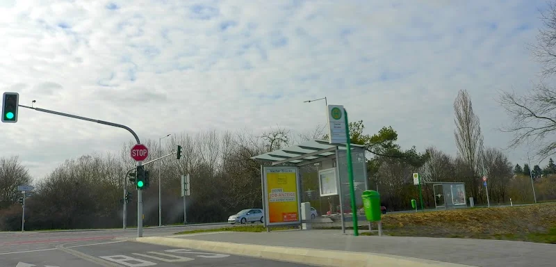
Access by bus: Vacher Bridge in public transport
The Vacher Bridge is not only relevant for car traffic but also primarily as a stop in public transport. The current timetable data from infra and VGN list the stop Vacher Bridge multiple times in the network, including on lines 171, 173, 174, and 175. This shows that the bridge and its surroundings are well integrated into daily traffic. For passengers, it is particularly important that the stop appears at different stop numbers and sometimes on different sides of the street depending on the line. This is typical for a traffic area where multiple line branches, school trips, and transfer relationships converge. Therefore, anyone wanting to go to the Vacher Bridge should pay attention not only to the name of the stop but also to the respective direction of travel and the timetable information of the line. ([infra-fuerth.de](https://www.infra-fuerth.de/fileadmin/pdf/produkte/mobilitaet/bus-und-u-bahn/Fahrplaene/Buslinie_171_infra_fuerth_reduziert.pdf?utm_source=openai))
Particularly interesting is the current school and commuter logic in northern Fürth. Infra reports that an additional school trip on line 174 now starts in Atzenhof and travels through Flexdorf and Vacher Market towards the city center. This eliminates the previous transfer at Vacher Bridge for many passengers, making the morning connection noticeably simpler. At the same time, lines 171 and 175 are now operated in a more even rhythm in the area of the clinic, improving connections. These indications are important because they show that the Vacher Bridge is not just a static location but an active hub in local mobility. Those visiting the bridge or transferring there benefit from a developed but continually adapted public transport structure. ([infra-fuerth.de](https://www.infra-fuerth.de/geschaeftskunden/die-infra/aktuelles?utm_source=openai))
Structure and technical data of the Zenn crossing
From a construction perspective, the Vacher Bridge is a classic infrastructure project, whose creation is closely linked to the expansion of the roadway. The historical bridge was built in 1970 as part of the relocation of Vacher Street after new traffic areas had to be created in the vicinity of the Main-Danube Canal and the land compensation for the US military. For this structure, the available documentation states a length of 123 meters and a width of 12 meters; the costs at that time were around 1.3 million D-marks. These values make it clear that the bridge was not a small crossing structure from the beginning but a significant road connection that was meant to safely and permanently span the Zenn. The fact that the bridge later became the focus of renovation and replacement construction is therefore more a result of its traffic significance than an isolated case. ([fuerthwiki.de](https://www.fuerthwiki.de/wiki/index.php/Vacher_Zennbr%C3%BCcke))
The renewal of the Vacher Bridge was ultimately implemented as a separate project. Implenia describes the new construction as Vacher Bridge BW 032 over the Zenn and mentions a 6-field, longitudinally two-beam slab bridge with a superstructure length of 121.40 meters. The measure included not only the bridge structure itself but also the connections at the junction of Vacher Street and Stadelner Street as well as at the junction of Flexdorfer Street. Particularly practical was that the new bridge was constructed alongside the existing bridge. This allowed motor vehicle, bicycle, and pedestrian traffic, as well as public transport, to continue during the construction period. This construction method shows how strongly the connecting function of the bridge was prioritized: The goal was not the closure but the securing of traffic flow. That is why the Vacher Bridge is a good example of modern replacement structures in urban areas. ([implenia.com](https://implenia.com/referenzen/detail/ref/vacher-bruecke/?utm_source=openai))
Why the bridge was rebuilt
The old Vacher Bridge developed over the years into a real traffic issue. According to FürthWiki, significant damage had already been identified on the structure, which had spread considerably. Therefore, heavy traffic over twelve tons had to be banned in the summer of 2015. This is an important point for anyone searching for Vacher Bridge closed: The search refers not only to current diversions but also to a longer history of load limits and structural problems. Because a simple basic renovation was no longer sufficient, a decision was made for a replacement construction. This decision is typical for bridges where long-term load-bearing capacity and traffic safety can no longer be achieved with a minor renovation. The case of the Vacher Bridge thus vividly illustrates how a local bottleneck became a comprehensive infrastructure project. ([fuerthwiki.de](https://www.fuerthwiki.de/wiki/index.php/Vacher_Zennbr%C3%BCcke))
The actual construction phase began in October 2016, the foundation work with bored piles started in January 2017 at depths of 15 to 20 meters, and shortly before Christmas 2017, the new bridge was opened to traffic. The costs are also clearly stated in the sources: around 6.7 million euros for the replacement construction. This timeline is important for contextualization because it explains why the Vacher Bridge is associated with construction, closure, and reopening in many search queries. Since then, the question has not been whether a crossing exists at all, but how the bridge is integrated into the currently valid traffic network. For searchers, this is reassuring information: The local network has not been abandoned but technically modernized and adapted to traffic requirements. ([fuerthwiki.de](https://www.fuerthwiki.de/wiki/index.php/Vacher_Zennbr%C3%BCcke))
Vach, Zenn, and daily life around the bridge
The Vacher Bridge is also a highly sought-after location because it lies in the midst of a developed, everyday urban space. Vach is a district of Fürth with its own identity, and the bridge over the Zenn is a visible part of this locality. Available images and descriptions make it clear that the bridge is not only a traffic area but also a point of orientation in the landscape between river, edge of the town, and traffic axes. For people who live there or regularly pass through, it is therefore less a spectacular landmark than a familiar fixed point in their daily routine. This mix of function and local color makes the Vacher Bridge interesting: It connects not only street sides but also districts, school routes, paths to work, and short everyday distances. ([fuerthwiki.de](https://www.fuerthwiki.de/wiki/index.php/Vacher_Zennbr%C3%BCcke))
Even in the surrounding area, the bridge plays an important role. The route layouts of infra show that the Vacher Bridge interacts with Vacher Market, Mannhof, Waterworks, Herboldshof, Vach Station, and the connections towards Atzenhof and the city center. Thus, it is part of a small but functionally important traffic area where local routes and regional commuting movements meet. From an SEO perspective, this is crucial: Those searching for Vacher Bridge Fürth, Vacher Bridge closed, or Bridge Vacha usually do not want an abstract description but a reliable orientation. The Vacher Bridge provides this orientation because it is readable as a Zenn crossing, stop location, and historically remodeled connection. This multifunctionality makes it a relevant search topic in northern Fürth. ([infra-fuerth.de](https://www.infra-fuerth.de/geschaeftskunden/die-infra/aktuelles?utm_source=openai))
Sources:
Mehr anzeigenWeniger anzeigen
Vacher Bridge | closed & Fürth
Those searching for the Vacher Bridge in Fürth usually want to know right away whether the structure is currently passable, what it is properly called, and what role it plays in the daily life of the district. That is precisely why the Vacher Bridge is much more than just a point on the city map: It is an important crossing over the Zenn in the district of Vach, a reference point for local traffic, and has been a topic of discussion for commuters, residents, and public transport for years. Today's search queries therefore often contain a mix of orientation, traffic situation, history, and practical route planning. The bridge is not only locally significant but also a good example of how infrastructure, local development, and mobility interact in the northern part of Fürth. Available sources show: The bridge has been historically adjusted multiple times, it has been renamed, rebuilt, and integrated into the transport network. ([fuerthwiki.de](https://www.fuerthwiki.de/wiki/index.php/Vacher_Zennbr%C3%BCcke))
Is the Vacher Bridge currently closed?
The question of a closure is particularly relevant for the Vacher Bridge because the structure has been associated with restrictions, construction work, and diversions in recent years. However, the currently available timetable data still lists the stop Vacher Bridge, which is an important indication that the location remains integrated into the ongoing public transport network. At the same time, the city of Fürth regularly shows that closures in the area of Vacher Street and its bridge sections are published separately and often only affect specific sections or time windows. Therefore, anyone searching for the Vacher Bridge should always distinguish between the specific bridge structure over the Zenn and other construction sites in the broader street section. This differentiation is important for searchers because Vacher Street in northern Fürth bundles several infrastructural nodes, stops, and crossings. ([infra-fuerth.de](https://www.infra-fuerth.de/fileadmin/pdf/produkte/mobilitaet/bus-und-u-bahn/Fahrplaene/Buslinie_171_infra_fuerth_reduziert.pdf?utm_source=openai))
Historically, the bridge was never just a silent structure without traffic problems. The previous bridge had been so severely damaged years ago that heavy traffic over twelve tons had to be banned in the summer of 2015. Subsequently, not only was it renovated, but a replacement construction was prepared to secure traffic flow permanently. Particularly important is: During the construction phase, the traffic connection was maintained because the new bridge was built alongside the existing bridge. This explains why the Vacher Bridge often appears in search queries with terms like closed, diversion, and new construction. For users, this means: Current timetable data and local construction information are the most reliable indicators when it comes to current passability. ([fuerthwiki.de](https://www.fuerthwiki.de/wiki/index.php/Vacher_Zennbr%C3%BCcke))
Location, course, and name change of the Vacher Bridge
The Vacher Bridge is located in the Fürth district of Vach and connects Vacher Street with the crossing over the Zenn. According to available sources, it is part of the local road network between Fürth and Vach and is therefore not an isolated structure but part of an important traffic section in the northern part of the city. For spatial orientation, this is helpful: Those coming from Fürth or the northern districts often encounter the bridge in daily life as part of a cohesive axis with Vacher Street, Stadelner Street, and Flexdorfer Street. Implenia explicitly describes the construction site of the renewal as a measure along Vacher Street between Fürth and the district of Vach. This makes it clear that the bridge primarily has a connecting function and directs traffic over the Zenn. ([implenia.com](https://implenia.com/referenzen/detail/ref/vacher-bruecke/?utm_source=openai))
The current name Vacher Zennbrücke is explained by the municipal naming practice: The city council decided in 2012 to rename the former Vacher Bridge to Vacher Zennbrücke to avoid confusion with the Vacher Regnitz Bridge located east of Vach. The decision is documented in Fürth-Wiki and simultaneously refers to the factual origin of the name, as the bridge crosses the Zenn. This name change is important for search engine optimization because many users continue to search for the old term, while current documents and entries often already use the new designation. Therefore, anyone searching for Vacher Bridge, Vacher Zennbrücke, or Bridge in Vach usually refers to the same local crossing over the Zenn. The sources show a typical situation in municipal language use: A historical name remains alive in everyday life while the official designation has become more precise. ([stadtrat.fuerth.de](https://stadtrat.fuerth.de/vo0050.asp?__kvonr=47104))
Access by bus: Vacher Bridge in public transport
The Vacher Bridge is not only relevant for car traffic but also primarily as a stop in public transport. The current timetable data from infra and VGN list the stop Vacher Bridge multiple times in the network, including on lines 171, 173, 174, and 175. This shows that the bridge and its surroundings are well integrated into daily traffic. For passengers, it is particularly important that the stop appears at different stop numbers and sometimes on different sides of the street depending on the line. This is typical for a traffic area where multiple line branches, school trips, and transfer relationships converge. Therefore, anyone wanting to go to the Vacher Bridge should pay attention not only to the name of the stop but also to the respective direction of travel and the timetable information of the line. ([infra-fuerth.de](https://www.infra-fuerth.de/fileadmin/pdf/produkte/mobilitaet/bus-und-u-bahn/Fahrplaene/Buslinie_171_infra_fuerth_reduziert.pdf?utm_source=openai))
Particularly interesting is the current school and commuter logic in northern Fürth. Infra reports that an additional school trip on line 174 now starts in Atzenhof and travels through Flexdorf and Vacher Market towards the city center. This eliminates the previous transfer at Vacher Bridge for many passengers, making the morning connection noticeably simpler. At the same time, lines 171 and 175 are now operated in a more even rhythm in the area of the clinic, improving connections. These indications are important because they show that the Vacher Bridge is not just a static location but an active hub in local mobility. Those visiting the bridge or transferring there benefit from a developed but continually adapted public transport structure. ([infra-fuerth.de](https://www.infra-fuerth.de/geschaeftskunden/die-infra/aktuelles?utm_source=openai))
Structure and technical data of the Zenn crossing
From a construction perspective, the Vacher Bridge is a classic infrastructure project, whose creation is closely linked to the expansion of the roadway. The historical bridge was built in 1970 as part of the relocation of Vacher Street after new traffic areas had to be created in the vicinity of the Main-Danube Canal and the land compensation for the US military. For this structure, the available documentation states a length of 123 meters and a width of 12 meters; the costs at that time were around 1.3 million D-marks. These values make it clear that the bridge was not a small crossing structure from the beginning but a significant road connection that was meant to safely and permanently span the Zenn. The fact that the bridge later became the focus of renovation and replacement construction is therefore more a result of its traffic significance than an isolated case. ([fuerthwiki.de](https://www.fuerthwiki.de/wiki/index.php/Vacher_Zennbr%C3%BCcke))
The renewal of the Vacher Bridge was ultimately implemented as a separate project. Implenia describes the new construction as Vacher Bridge BW 032 over the Zenn and mentions a 6-field, longitudinally two-beam slab bridge with a superstructure length of 121.40 meters. The measure included not only the bridge structure itself but also the connections at the junction of Vacher Street and Stadelner Street as well as at the junction of Flexdorfer Street. Particularly practical was that the new bridge was constructed alongside the existing bridge. This allowed motor vehicle, bicycle, and pedestrian traffic, as well as public transport, to continue during the construction period. This construction method shows how strongly the connecting function of the bridge was prioritized: The goal was not the closure but the securing of traffic flow. That is why the Vacher Bridge is a good example of modern replacement structures in urban areas. ([implenia.com](https://implenia.com/referenzen/detail/ref/vacher-bruecke/?utm_source=openai))
Why the bridge was rebuilt
The old Vacher Bridge developed over the years into a real traffic issue. According to FürthWiki, significant damage had already been identified on the structure, which had spread considerably. Therefore, heavy traffic over twelve tons had to be banned in the summer of 2015. This is an important point for anyone searching for Vacher Bridge closed: The search refers not only to current diversions but also to a longer history of load limits and structural problems. Because a simple basic renovation was no longer sufficient, a decision was made for a replacement construction. This decision is typical for bridges where long-term load-bearing capacity and traffic safety can no longer be achieved with a minor renovation. The case of the Vacher Bridge thus vividly illustrates how a local bottleneck became a comprehensive infrastructure project. ([fuerthwiki.de](https://www.fuerthwiki.de/wiki/index.php/Vacher_Zennbr%C3%BCcke))
The actual construction phase began in October 2016, the foundation work with bored piles started in January 2017 at depths of 15 to 20 meters, and shortly before Christmas 2017, the new bridge was opened to traffic. The costs are also clearly stated in the sources: around 6.7 million euros for the replacement construction. This timeline is important for contextualization because it explains why the Vacher Bridge is associated with construction, closure, and reopening in many search queries. Since then, the question has not been whether a crossing exists at all, but how the bridge is integrated into the currently valid traffic network. For searchers, this is reassuring information: The local network has not been abandoned but technically modernized and adapted to traffic requirements. ([fuerthwiki.de](https://www.fuerthwiki.de/wiki/index.php/Vacher_Zennbr%C3%BCcke))
Vach, Zenn, and daily life around the bridge
The Vacher Bridge is also a highly sought-after location because it lies in the midst of a developed, everyday urban space. Vach is a district of Fürth with its own identity, and the bridge over the Zenn is a visible part of this locality. Available images and descriptions make it clear that the bridge is not only a traffic area but also a point of orientation in the landscape between river, edge of the town, and traffic axes. For people who live there or regularly pass through, it is therefore less a spectacular landmark than a familiar fixed point in their daily routine. This mix of function and local color makes the Vacher Bridge interesting: It connects not only street sides but also districts, school routes, paths to work, and short everyday distances. ([fuerthwiki.de](https://www.fuerthwiki.de/wiki/index.php/Vacher_Zennbr%C3%BCcke))
Even in the surrounding area, the bridge plays an important role. The route layouts of infra show that the Vacher Bridge interacts with Vacher Market, Mannhof, Waterworks, Herboldshof, Vach Station, and the connections towards Atzenhof and the city center. Thus, it is part of a small but functionally important traffic area where local routes and regional commuting movements meet. From an SEO perspective, this is crucial: Those searching for Vacher Bridge Fürth, Vacher Bridge closed, or Bridge Vacha usually do not want an abstract description but a reliable orientation. The Vacher Bridge provides this orientation because it is readable as a Zenn crossing, stop location, and historically remodeled connection. This multifunctionality makes it a relevant search topic in northern Fürth. ([infra-fuerth.de](https://www.infra-fuerth.de/geschaeftskunden/die-infra/aktuelles?utm_source=openai))
Sources:
Upcoming Events
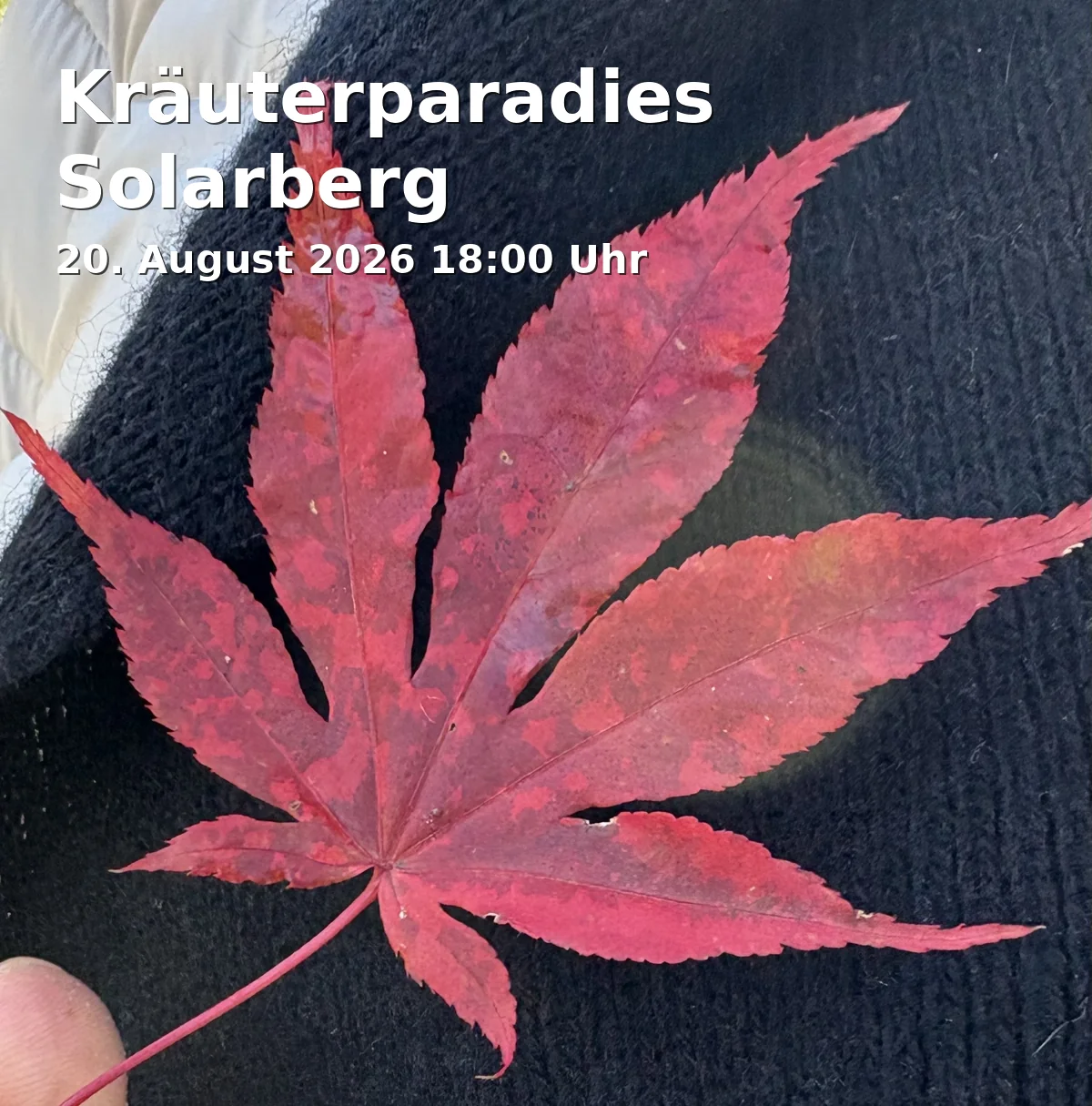
Herb Paradise Solarberg
Nature, Knowledge, and Enjoyment at Fürth's Solarberg: The wild herb hike leads to edible plants and small samples. 20.08.2026, 18:00–20:00, 17 €. #Fürth #Herbs
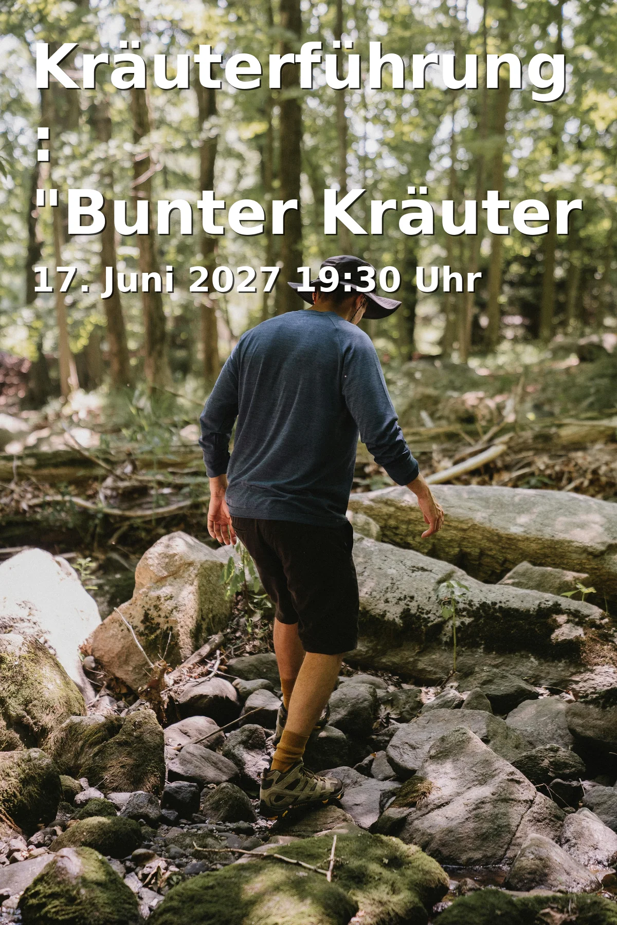
Herb Walk: "Colorful Herbs for the Summer Solstice"
A summer evening for nature fans in Fürth: Herb Walk with wild plants, views, and herb buffet. June 17, 2027, free entrance. Discover now! #Fürth #Herbs
Frequently Asked Questions
Reviews
Moji m2016
30. June 2017